Love weekends on the water or quiet mornings on a shaded trail? In Clay County, you can do both without going far from home. Whether you’re a longtime local or you’re exploring neighborhoods for a move, parks, trails, and public boat ramps shape daily life here. In this guide, you’ll learn where to focus, what to check before you go, and how outdoor access can support your home search. Let’s dive in.
Clay County outdoor lifestyle at a glance
Clay County sits just west and south of Jacksonville, with the St. Johns River flowing through the heart of the area and tributaries like Black Creek feeding in. The St. Johns is the major waterway for boating, fishing, and public boat access in the county. That river access, plus a network of local parks and trails, is a big lifestyle draw for many buyers and sellers.
The county’s population was about 218,000 in the 2020 U.S. Census. You can explore updated estimates on the U.S. Census Bureau’s QuickFacts page for Clay County to understand the size and growth of the community. The scale of the county means you’ll find a mix of riverfront parks, neighborhood playgrounds, and natural areas within a short drive of most neighborhoods. If outdoor time matters to you, location really can shape your day-to-day.
Explore Clay County QuickFacts on the U.S. Census Bureau
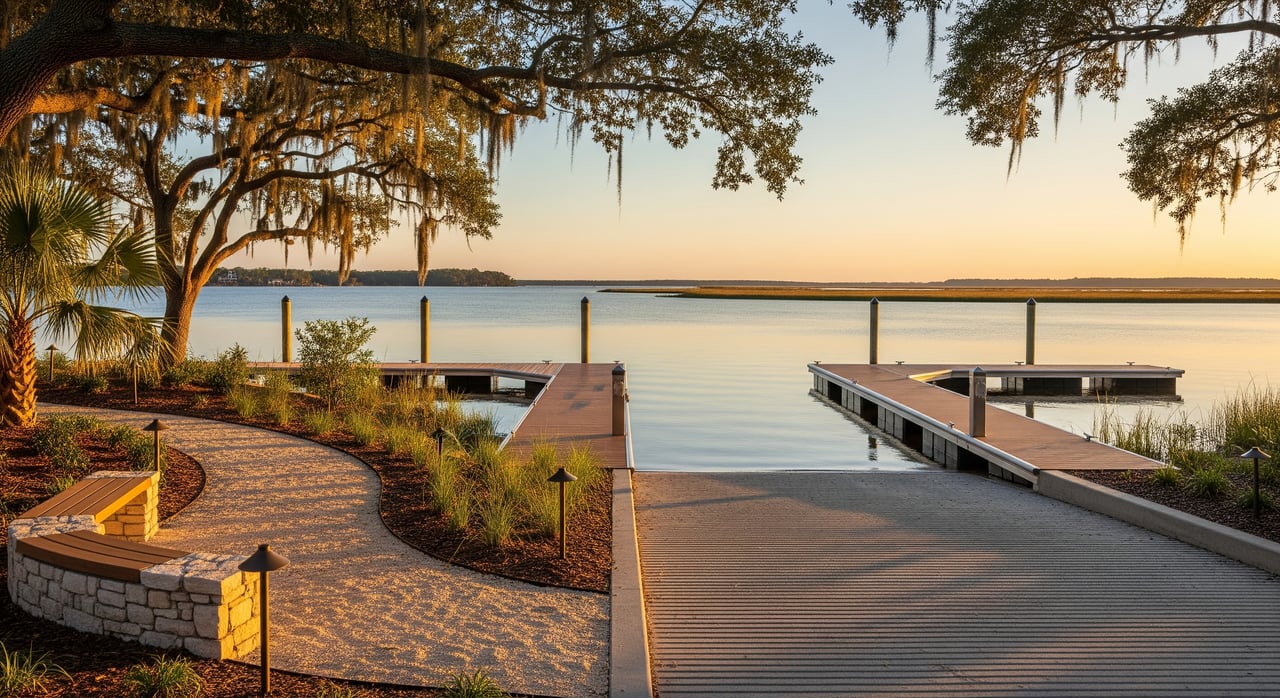
Riverfront parks and boat access
If boating, fishing, or paddling is on your list, focus on sites along the St. Johns River and nearby creeks. You’ll find a mix of county-managed parks, municipal waterfront parks, and places with ramps or hand-launch areas. Some sites sit close to town centers, while others feel more natural and quiet.
Here’s what you can expect to find across the county’s riverfront areas:
- Public parks that offer picnic areas, restrooms at larger sites, and shoreline access.
- Boat ramps that serve powerboats, plus a few hand launches better suited for kayaks and canoes.
- Trailer parking areas that vary in size. Many sites prohibit overnight parking.
- Posted rules about hours, pets on leash, and no-wake or speed zones near busy landings.
Before you head out, use official sources to confirm current conditions, hours, and fees. Clay County and individual cities manage different facilities, so rules can change by site.
Find parks and contacts on the Clay County Government site
What to know before you launch
Ramps can differ a lot from one site to the next. A quick check saves time and hassle at the water’s edge.
Use this ramp-ready checklist:
- Ramp details. Confirm the surface type, number of lanes, available staging area, and water depth at typical tides or river levels. Larger boats may need extra turnaround room.
- Trailer parking. Look for posted rules about day-use only vs. any permitted overnight parking. If in doubt, call the managing agency.
- Dock and shoreline. Check for courtesy docks, loading areas, and any no-wake zones nearby.
- Fees and hours. Verify day-use or launch fees, and confirm opening hours. Some parks lock gates overnight.
- Conditions. Seasonal water levels, debris, or maintenance can affect usability. A quick call or website check helps you avoid surprises.
For state rules and boating safety guidance, start with the Florida Fish and Wildlife Conservation Commission. You can also check registration and title details with Florida Highway Safety and Motor Vehicles.
- Review boating safety and education on the Florida Fish and Wildlife Conservation Commission
- Learn about vessels and registration on the Florida Highway Safety and Motor Vehicles
Safety and regulations for boaters
Florida requires vessels to be registered and display proper numbers. Operator education rules apply to certain age groups, and every vessel must carry U.S. Coast Guard approved life jackets and required safety gear. If you plan to fish, you may need a freshwater or saltwater license depending on where you launch and what you target. You’ll find current rules and license options on the FWC site.
- Get recreational fishing license details from the Florida Fish and Wildlife Conservation Commission
Florida also promotes invasive species prevention. Adopt Clean, Drain, Dry habits for your boat and gear to help protect local waterways. Ramp signage often reinforces these steps.
- Learn about invasive species prevention on the FWC conservation pages
Trails and greenways you can enjoy
Clay County offers a mix of paved multi-use paths and natural surface trails that wind through wetlands, along creeks, and near neighborhood parks. Paved sections are great for family biking, strollers, and joggers. Natural trails and boardwalks give you wildlife viewing and shaded walks.
Before you go, check trail length, surface, and permitted uses. Most public trails prohibit motorized vehicles. If you’re new to an area, online trail platforms can help you preview maps, photos, and user notes.
- Browse trail maps and surfaces on TrailLink by Rails-to-Trails Conservancy
Trail-day checklist
Pack smart and plan for Florida conditions. A few simple steps make your day smoother.
- Water and sun. Bring water, sunscreen, and a hat. Many trailheads have limited shade and water access.
- Footing and wheels. Choose footwear for the surface type. For strollers and bikes, confirm paved vs. natural segments.
- Safety. Expect wildlife near water, including alligators. Keep a safe distance and never feed wildlife.
- Weather and flooding. Summer storms and seasonal flooding can affect access. Check conditions before you go.
- Hours and rules. Follow posted hours, leash rules for pets, and keep to the right on shared paths.
Family parks and dog-friendly spaces
Neighborhood and community parks in Clay County offer playgrounds, open lawns, and sports fields. Some locations have pavilions that you can reserve for birthday parties or gatherings. Larger parks often include restrooms and paved paths for easier access.
Dog-friendly areas are common. Expect leash rules and pet waste stations at many sites. Always check posted signs for local rules, hours, and any restrictions before you visit.
Planning your park or ramp day
A little prep goes a long way. Here are a few practical tips to keep your visit relaxed.
Parking, restrooms, and fees
- Facilities vary. Larger county or city parks often have restrooms and potable water. Smaller natural areas may not. Check the park page before you go.
- Parking. If you have a trailer, make sure the lot allows trailer parking. Avoid blocking spaces reserved for vehicles without trailers.
- Pavilions. If you want a covered space for a gathering, look for advance reservations and any rental fees.
Peak times and seasons
- Weekends and holidays. Expect heavier boating traffic on the St. Johns River, especially during warm months.
- Hurricane season. From June to November, storm systems can raise water levels, bring debris, and cause temporary closures. Keep an eye on county updates.
- Algae advisories. Warm weather sometimes brings blue-green algae in Florida waterways. Follow official health advisories and posted signs before swimming or fishing.
How outdoor access supports your home search
For many buyers, access to parks, trails, and boat launches is a key part of lifestyle and property value. Living close to a favorite river park or trail can make weekday walks or after-school bike rides easier. If you own a boat or plan to buy one, a convenient ramp can save you time and reduce towing miles.
Keep these points in mind while you compare homes:
- Proximity. Note drive times to your go-to launch, river park, or trailhead during peak hours, not just midday.
- Noise and traffic. Ramps and popular riverfront parks can be busy on weekends. Visit at different times to understand traffic patterns.
- Flood risk. Riverfront areas can face seasonal flooding. Check a property’s flood zone and consider insurance implications.
- Future projects. Planned trail or park investments can improve access and walkability. Watch city and county updates for new amenities.
To evaluate flood risk, use the FEMA Flood Map Service Center to review current maps for a specific address.
Check property flood zones with FEMA Flood Map Service Center
Helpful local resources
Use these official resources to plan your next outing and verify rules before you go:
- Park listings and contacts on the Clay County Government site
- Boating safety education and rules from the Florida Fish and Wildlife Conservation Commission
- Vessel registration and titles at Florida Highway Safety and Motor Vehicles
- Recreational fishing license information on the FWC license page
- Invasive species prevention guidance from FWC conservation
- Florida’s state-managed parks on Florida State Parks
- Trail previews and maps on TrailLink
- County demographics on U.S. Census Bureau QuickFacts
Ready to align your home search with your favorite river park, trail, or boat ramp? Let’s match neighborhoods to the outdoor lifestyle you want. Reach out to Leslie Smith to schedule your free neighborhood consultation.
FAQs
Are there public boat ramps in Clay County?
- Yes. There are public access points that serve the St. Johns River and nearby creeks. Verify exact locations, fees, and hours with the county or the FWC resources before you go.
Which boat ramps fit larger boats and trailers?
- Suitability varies by ramp. Confirm lane count, water depth, staging space, and turnaround room with the managing agency, and plan weekday launches when possible if you have a larger rig.
Where can you kayak or canoe in Clay County?
- Expect hand-launch areas along the St. Johns River and tributaries. Check park pages for permitted uses and look for outfitters nearby if you prefer guided trips.
Are there paved, bike-friendly trails in the area?
- Yes. You will find paved greenways and multi-use paths near population centers, plus natural surface trails in park settings. Confirm surfaces and permitted uses before you head out.
Can you park a boat trailer overnight at public ramps?
- Overnight parking is often restricted or prohibited. Check posted signs and the managing agency’s rules. When in doubt, call ahead.
Do parks have restrooms and drinking water?
- Larger parks often do, while smaller natural areas may not. Review the park’s official page for facilities and plan to bring water if services are limited.